Kommugudem Fm
Type Locality and Naming
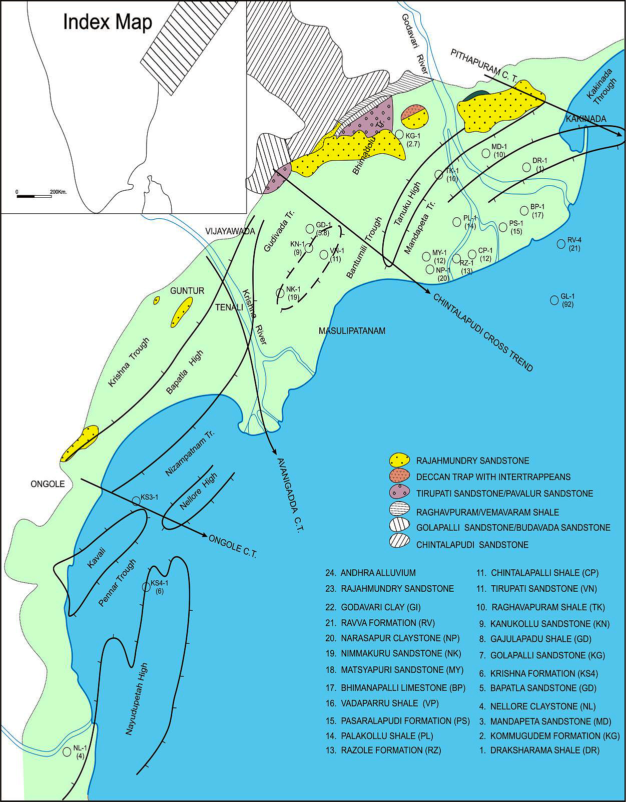
BASINAL: The type section is located at exploratory well Kommugudem-A (depth interval: 4500-3315m), in the Gudivada subbasin. The hypostratotype is in the well Mandapeta-A (depth interval: 4215-3315 m). It was named after the Kommugudem village by ONGC team steered by Venkatarengan et al. (1993) and issued as Document-VII by KDMIPE, ONGC, Dehradun (1993). [Original Publication: Rao, G.N. (1990) Subsurface stratigraphic nomenclature of Krishna-Godavari Basin, ONGC, unpublished report.]. Reference well: Mandapeta – A, Interval 3315-4215 m and thickness 900 m.
[Figure: Map showing the locations of designated holostratotype section for the formation in the KG Basin (After ONGC, Pandey and Dave, 1998) in Raju et al., 2021, ONGC Bulletin, Special Issue, Vol. 56, No. 2]
Lithology and Thickness
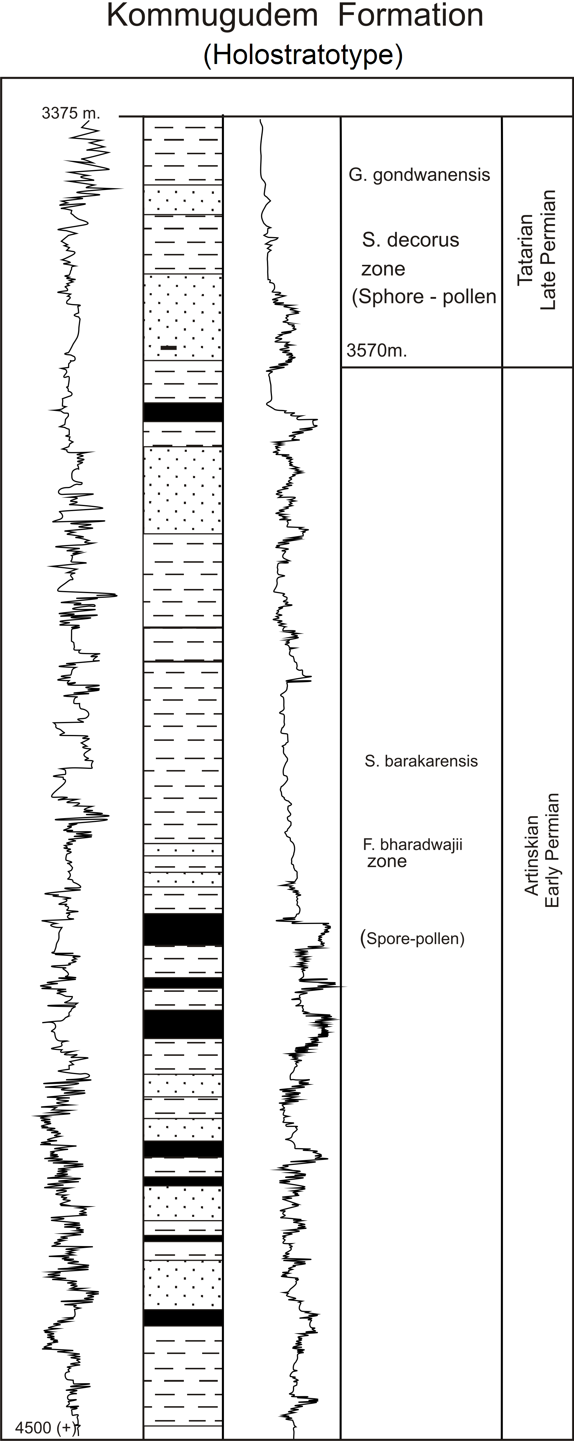
Clayey sandstone. An alternation of sand and shale layers with coal beds constitutes this formation. Sands are dirty white, medium grained, felspathic and friable. The shales are dark gray to black, hard, compact, silty and occasionally sandy. The coal is soft and embedded with the shales. Its thickness varies from 900-1185 m.
[Figure 1: Lithocolumn with corresponding GR and Resistivity logs of the holostratotype of Kommugudem Formation in the Well Kommugudem-A (Source: Venkatrengan et al., 1993 and Bijai Prasad, 1999)]
Relationships and Distribution
Lower contact
In the type section, the lower boundary is yet to be penetrated. However, in Draksharama-1 and Mandapeta-1, the top of the Draksharama Fm and Archean basement respectively underlie the formation.
Upper contact
It is unconformably overlain by the Mandapeta Fm Sandstone and has an arbitrary cut off against the Tanuku Formation.
Regional extent
GeoJSON
Fossils
Spore-pollen- F. bharadwajii, S. barakarensis, S. decorus and G. gondwanensis
Age
Depositional setting
Fluvial to lagoonal.
Additional Information
The Kommugudem Formation is the source rock for the petroleum-gas reservoirs in the Mandapeta Fm sandstone.

